Valencia is particularly known for its beaches. However, mountain lovers will also find interesting summits to scale in the area around the city. Prehistoric caves and shelters, towers, walls, a wide variety of landscapes, fauna, flora and vantage points with views of the sea or Mediterranean flatlands and valleys. Looking to conquer these peaks? Get ready for some interesting recommendations. Let’s go!
Monte Picayo, en Puzol. 24 minutes from Valencia
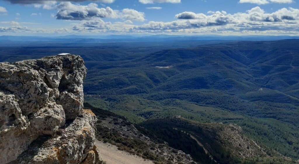
This peak in the Iberian System is located near the municipality of Puzol. It tops 373 metres above sea level, and the area is criss-crossed by numerous trails. As a result, there is no one path up to the top or an established time. It all depends on the pace you set and whether you opt for an easier route or a more athletic one.
The town is 18 km from Valencia, accessible via the V-21 road or by RENFE local train (cercanías). Once in Puzol, the lower slope of Picayo is 2 km from the town centre, near the Alfinach and Los Monasterios housing developments.
There are several access points. From La Costera Natural Area, the hill to the south of Picayo and the last spur of the Calderona Mountains; or from the end of Josep Alfonso Street, where there is a small open area for parking. In both cases, the trails meet on the climb up the ravine known as Barranc del Llop, and for 1 km, this section coincides with the GR-10 – European long-distance trail E-7, which links the Mediterranean and the Atlantic, from Puzol to Lisbon.
Another option is from Cansalader Street or Camí de la Caseta del Cansalader road in the Los Monasterios Development. The route is more roundabout, but it runs along a well-maintained forest track, suitable for hikers and vehicles. And there is another unmarked trail from the Monte Picayo Development, at the end of Paseo de las Cumbres road.
If you prefer longer distances, there is another option: departing from Gilet, either from Sant Esperit Monastery along the GR10, or from the Vall de Sant Esperit Development, via Balau Ravine and the Guaita Rocks.
The main points of interest along this route are the prehistoric shelters along Barranc del Llop and the views from the summit, as well as Virgen Milagrosa Chapel.
Besori Hill, Llombai. 34 minutes from Valencia
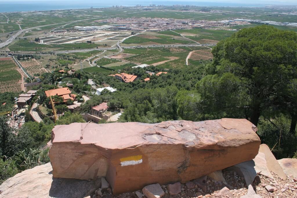
This is the first mountainous spot in this area when travelling inland from the coast, offering magnificent views of the Mediterranean coastal plain and valleys of the Marquesat district. The natural environment is spectacular, and the local fauna, flora and landscape have earned it the distinction of being recognised as the El Tello Municipal Natural Area.
The mountain itself reaches a maximum height of 360 metres. At the summit there is a lookout tower for the prevention of forest fires, an indication of the hill’s incomparable location. The climb is easy to follow, despite not being waymarked, but demanding, with regular, long sections in excess of 20%. The average gradient is over 17%, providing a very appealing elevation gain. However, these characteristics have produced heavily eroded sections. As a result, an alternative route is being designed. Climbing time ranges from 45 to 75 minutes.
The town of Llombai is around 30 minutes from Valencia, via the A7 motorway and the CV-520 road. Once in town, Paraje del Tello and Besori Peak can be reached via the ford across the River Magro. There is infrastructure for parking near the protected space, making it easy to access while still preserving the area.
There are other municipal natural areas nearby, including El Tello, Els Cerros and La Colaita, where visitors can enjoy hiking and mountain biking trails amid spectacular scenery.
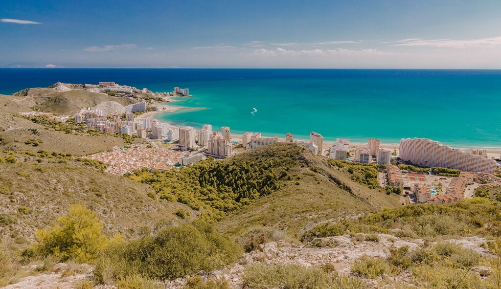
Cullera Mountain. 39 minutes from Valencia
Also known as Muntanya de L’Or or Muntanya de les Raboses, this peak rises to 233 metres parallel to the coastline. The majority of the town of Cullera lies to the south and east of its lower slopes. It is easy to climb, with a gentle profile and few steep gradients. In fact, its slopes have long been occupied, and the trail leads to the top along a longitudinal upward route that poses few challenges. This makes it suitable for all ages and abilities.
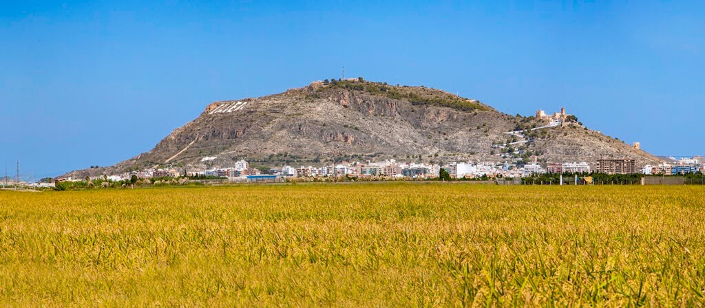
It can be recognised by the name ‘Cullera’, repainted on the peak each year in gleaming white paint. The name Muntanya de les Raboses (Fox Mountain) comes from the fact that at one time it was home to many rabbits, and therefore, there were also a considerable number of foxes in the area. The southern part of the summit is paved, providing access to Cullera Castle. It is an excellent viewpoint overlooking the local scenery. There are a number of spots of archaeological interest that reflect the succession of civilisations that have settled along this stretch of the Valencian coastline.
By car, the main approach road is the AP-7. Heading north out of the city of Valencia, you can also reach Cullera via the AP-7 connecting to the A-38, or via the Saler motorway, CV-500. Driving time is 45 to 50 minutes. Another option is a local train (cercanías line C1. Valencia–Gandía) from Norte Station, which takes approximately 35 minutes. Once at Cullera station, take a local bus to Rambla San Isidro in the town centre, and from there to the Mercado Gardens, beginning the climb up the mountain along the Calvary Walk (Camino del Calvario).
Cullera Mountain has several natural and cultural attractions: Sant Llorenç Pond; Racó de Santa Marta; the castle, the Museum of History and Archaeology; and the walled area of the second cowshed with its five towers and walls; the Calvary Walk with its 18th-century stations; Volcán del Faro Cave etc.
Caroche or Caroig Peak, Teresa de Cofrentes. Two hours from Valencia
This is the highest peak in the Caroche Massif (1126 metres above sea level), a mountainous area that runs through the districts of Valle de Ayora-Cofrentes and La Canal de Navarrés, and part of La Costera and Hoya de Buñol. The most characteristic feature of Caroche Peak is probably its geographical location. Given its inaccessibility, it has changed very little, and it is therefore home to a broad diversity of landscapes, fauna and flora, creating a naturally and environmentally rich space. At the top there is a fire lookout station and a viewpoint overlooking most of the districts in Valencia, with the town of Cullera and even the sea being visible on clear days.

There is no public transport from Valencia or paved roads suitable for all vehicles. One way to access Caroche Peak is via the municipality of Teresa de Cofrentes. You can get there by car on the N-330 national road from Requena or Almansa and cross the municipality towards Caroche Peak via a forest track, which takes some 50 minutes from the town centre.
It can also be reached via the neighbouring town of Bicorp, in La Canal de Navarrés, via country road CV-580 and another forest track that climbs along the Cazuma River up to the same peak, on its east side. From Valencia, it takes a couple of hours, bearing in mind that the final stretches are winding and difficult for low vehicles.
From Caroche Peak, it is possible to spot three natural landmarks: Barchilla, Media Barchilla and Celemín, three rocky prominences that follow on from each other. They can also be reached on foot from the base of the peak, where Collado Lake is located. There are also natural springs that produce clean, clear water year-round.

